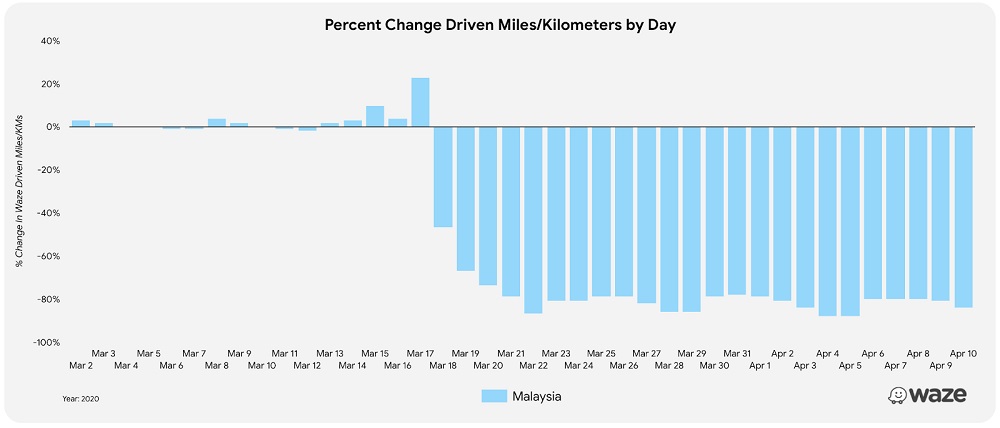
This is in line with the global reduction in driving, according to Waze’s data. That said, the driving reduction in Malaysia is greater than the global average, which is at 60% less kilometres driven. Of course, a massive reduction still means that there are still people out on the road. They could be essential service workers, or family members making grocery trips. For these people, Waze is working to add region-specific information about road closures, red zones, and other COVID-19 related information to the map.
In addition to those, Waze is also getting locations of testing centres and emergency food distribution centres from governments. This is so that those can also be added to the map. You can find out more about these numbers from the company’s Medium post, linked below. Waze has also prepared a landing page specifically for details on testing and food distribution centres, also linked below. (Source: Waze [1], [2])
